bGEO User Guide
Context menus
Route menu
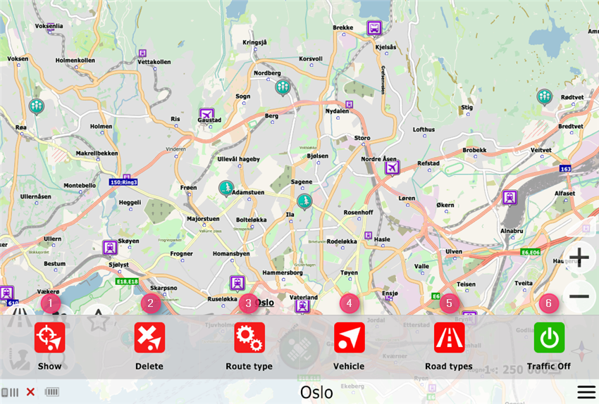
- Show the entire route
- Delete route
- Change the route type (optimal, shortest)
- Change the mode of transport (car, truck, motorcycle, pedestrian)
- Types of roads to use (yard, paid, soil roads, passing bays)
- Disable display and use of traffic jam
DPOI Menu
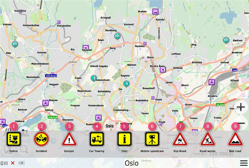
- Report a road patrol
- Report an accident (optionally you can specify the side of the roadway)
- Report the hazard on the road (optionally you can specify the side of the roadway)
- Report a working tow truck
- Write text
- Report a mobile radar gun
- Report the ice
- Report repair of the road (optionally you can specify the side of the roadway)
- Report pits on the road (optionally you can specify the side of the roadway)
Map menu
Called by tapping anywhere on the map
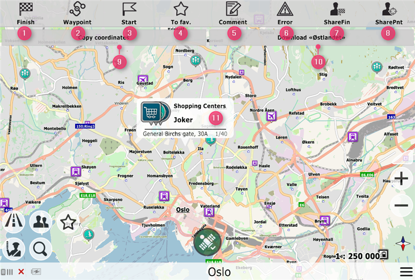
- Set as finish point
- Set as route waypoint
- Disable GPS-related binding or set as a start point (when GPS-related binding is disabled)
- Add to favorites
- Write a review on the object
- Report an error in the map
- Send a finish point to a friend
- Send this point to a friend
- Copy the coordinates of the specified point
- Fully download the entire map (of the region displayed on the screen) to work offline
- Information about the point (coordinates, POI, reviews, etc.)
In order to indicate the start point by force, call up the map menu and turn off the GPS, the button in the context menu will change its appearance and you can specify the starting point of the route.