bGEO User Guide
Quick Start
Quick Start
- Install bGEO.
- The first launch of the software can take a few seconds longer than the next ones.
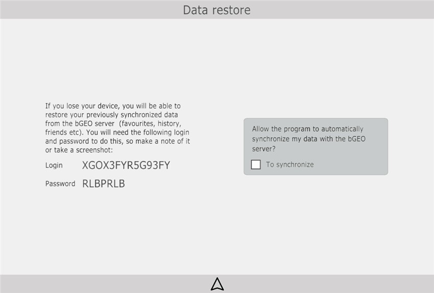
Languages of the interface and voice prompts will be set automatically, according to the system settings of the device. You can change these later using the settings. - Upon the first run, the software shows the screen for automatic synchronization of favorites and other data, we recommend that you keep login and password for future use in case the device would be lost.
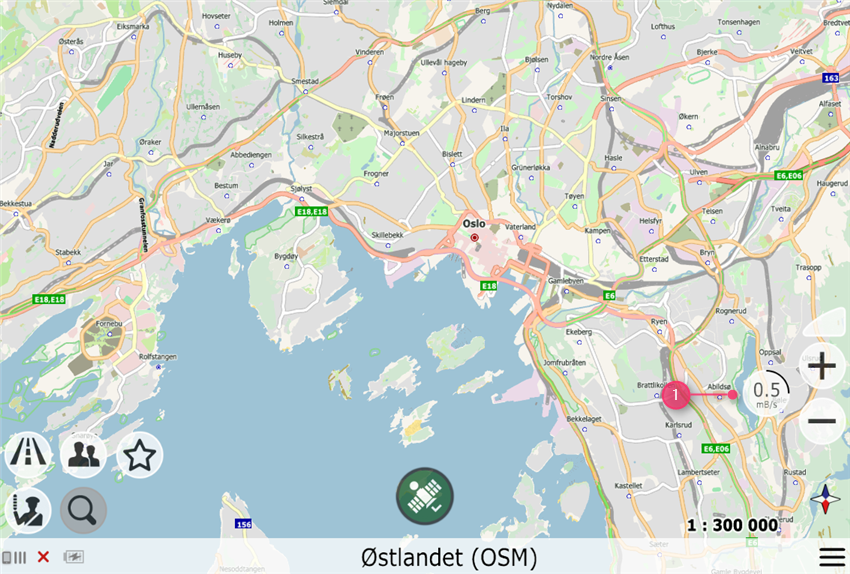
- After startup, the software will download the main map data. The right side of the screen shows the progress bar (1) indicating the data download rate (you can get more information about data use by clicking the bar).
- Immediately after the startup, only the main data will be loaded, which does not include the exact road graph, yard driveways, POI (Points of Interest), and search data. This data will be loaded additionally (data for search after you click the search button, road graph data after you specify the start and finish of the route).
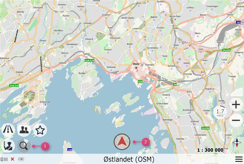
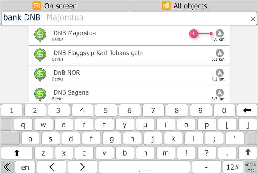
- Press the search button (1) and wait for the search data to be loaded (downloading data for search takes a few seconds and happens only once, and then the saved data is used). As soon as the search button changes from the dark state (there is no data for search yet) to light (the data is loaded), the menu of address voice input appears. You can say the address using voice or type it using the keyboard.
Note: the region where you want to make search must be displayed on the device screen (for example, if you want to find an address in Finland, scroll the map until the map of Finland appears on the screen.)
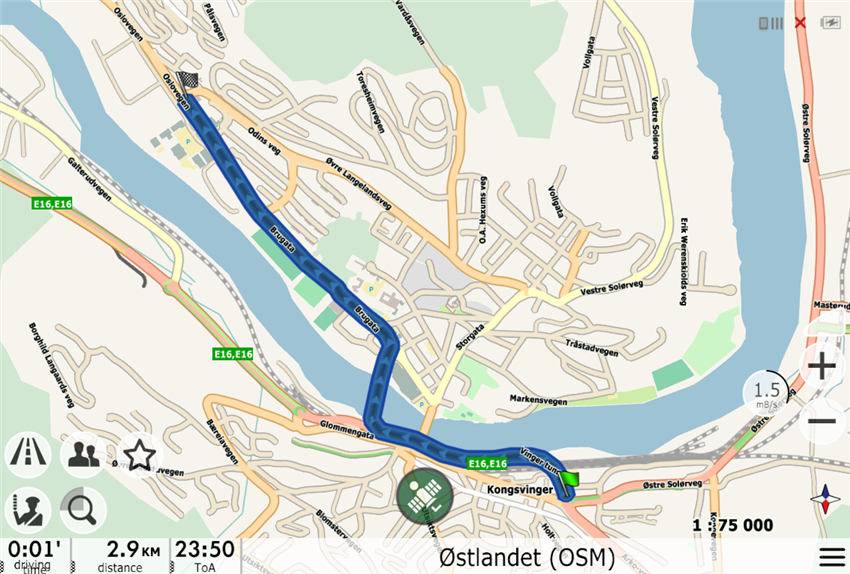
If you move the map, you can go back to the current location by pressing the button with the "hang-glider" (2) at the bottom of the screen. - After selecting the finish point, click the navigation button and the route will be calculated on the server and then transferred to your navigator.
- The server route visually differs in that it is not colored in the color of traffic jams, but always in blue.
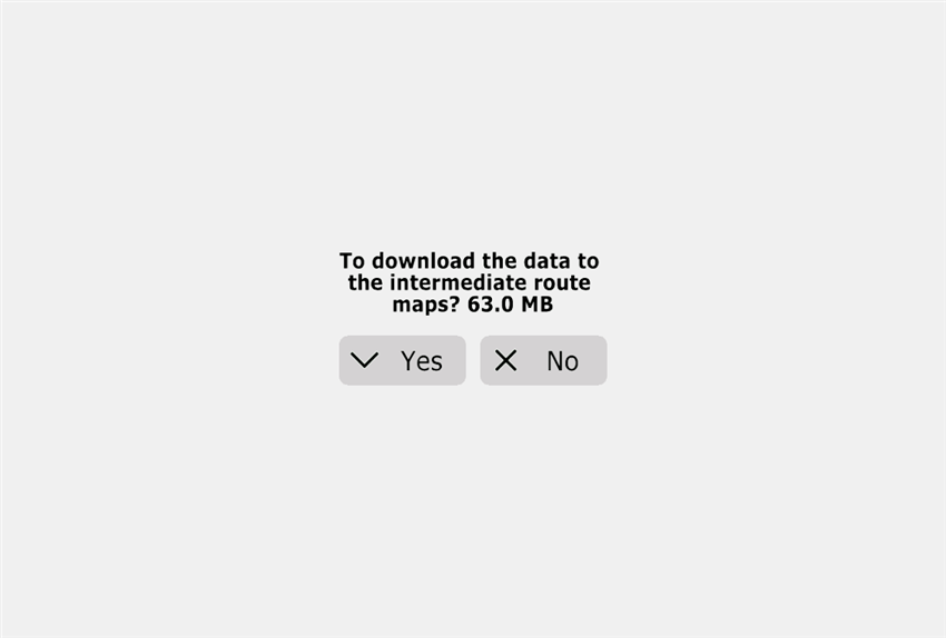
- If the route passes through several maps, the software will ask if you need to download data along the route. If confirmed, data along the route across the transitional maps will be downloaded. If you refuse to download data, the route between the start and finish maps will be laid over the base map.
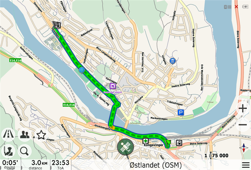
- After receiving the route from the server, you can start navigating. At this time (if not prohibited in the settings), the exact data on the road graph will be downloaded in the background and as soon as route data loading is completed, the route will be rebuilt locally on the device. This route will already be painted in the colors of traffic jams.
Remember that if you want to minimize the amount of data traffic transmitted over mobile networks, after starting the software for the first time (while on-line over a Wi-Fi network), build the route and wait until all data is downloaded.